DAYARA BUGYAL TREK

From

Duration

6 days

Tour Type

Overview

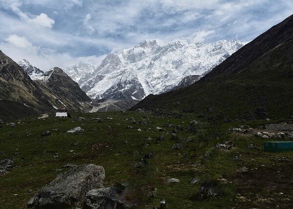
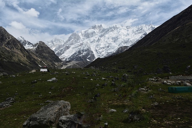
• Location: Chamoli District, Uttarakhand
• Altitude: 3,408 meters (Dayara Bugyal meadows)
• Trek Duration: 5–6 days
• Trek Type: Easy to Moderate – suitable for beginners
• Best Time to Visit:
o April – June: Spring bloom with green meadows and flowers
o September – November: Post-monsoon, clear skies, and lush greenery
• Starting Point: Uttarkashi or Liti Village
• Trek Distance: ~35–40 km round trip
Trek Highlights
• High-altitude meadows (Bugyals): Vast alpine grasslands perfect for camping and photography
• Himalayan Peaks: Views of Chaukhamba, Kedarnath, and Bandarpunch
• Alpine Flora: Rhododendrons, oak, pine, and seasonal wildflowers
• Streams and Rivers: Crystal-clear glacial streams along the trail
• Remote Villages: Experience traditional Garhwali lifestyle in Liti and surrounding villages

Included/Exclude

  • Pick and Drop Services
  • 1 Meal Per Day
  • Cruise Dinner & Music Event
  • Visit 7 Best Places in the City With Group
  • Additional Services
  • Insurance
  • Food & Drinks
  • Tickets

Tour Plan

• Route: Rishikesh / Dehradun → Uttarkashi → Liti
• Distance: ~200 km / 8–9 hours by road
• Elevation: 2,150 m
• Highlights: Scenic drive along Bhagirathi River, small Garhwali villages
• Overnight: Guesthouse in Liti

• Trek Distance: ~10 km
• Duration: 4–5 hours
• Elevation Gain: 2,150 m → 2,900 m
• Highlights:
o Oak and pine forests
o Mountain streams and small waterfalls
o Views of surrounding Himalayan peaks
• Camping: Panthaghati campsite
• Experience: Gentle ascent suitable for beginners

• Trek Distance: ~8–10 km
• Duration: 4–5 hours
• Elevation Gain: 2,900 m → 3,408 m
• Highlights:
o Vast green alpine meadows
o Panoramic views of Chaukhamba, Kedarnath, and Bandarpunch peaks
o Wildflowers during spring
• Camping: Dayara Bugyal campsite
• Experience: Easy trekking, perfect for photography and enjoying high-altitude meadows

• Distance: 4–6 km (local exploration)
• Elevation: 3,408 m
• Highlights:
o Sunrise & sunset over the Himalayan peaks
o Birdwatching and exploring alpine flora
o Optional short treks to nearby ridges for 360° views
• Camping: Dayara Bugyal

• Trek Distance: 8–10 km
• Duration: 4–5 hours
• Elevation Loss: 3,408 m → 2,900 m
• Highlights: Return trek through alpine meadows and pine forests
• Camping: Panthaghati campsite

• Trek Distance: 10 km trek
• Elevation Loss: 2,900 m → 2,150 m
• Highlights: Trek through forests and villages, end of trek
• Travel: Continue to Uttarkashi / Dehradun by road
• End of Trek

Related Tours

Review Scores

No reviews yet

Add a Comment

Your email address will not be published.

  • Quality
  • Location
  • Amenities
  • Services
  • Price

Booking Tour

Tour Information

Max Guests

50

Min Age

12+

Tour Location

Languages Support