• Location: Chamoli District, Uttarakhand, India
• Altitude: 4,750 meters (15,580 feet) – Kedartal Lake
• Trek Duration: 7–8 days
• Trek Type: Moderate to Strenuous
• Best Time to Visit:
o May – June: Pre-monsoon, clear skies
o September – October: Post-monsoon, stable weather
• Starting Point: Gangotri / Bhojbasa
• Trek Distance: ~70–80 km round trip
Trek Highlights
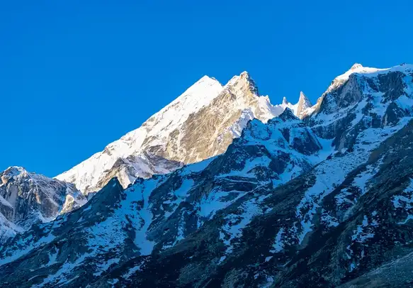
• Kedartal Lake: High-altitude glacial lake reflecting peaks like Thalay Sagar, Meru, and Shivling
• Gaumukh Glacier: Source of Bhagirathi River
• Peaks in view: Shivling, Meru, Thalay Sagar, Bhrigupanth, and Bhagirathi Massif
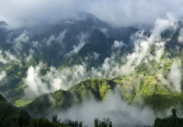
• Dense conifer and alpine forests along the trail
• Remote Himalayan valley experience – very less crowded
• Ridge walks and alpine meadows
KEDARTAL TREK
From
Duration
Tour Type
Overview
Included/Exclude
- Pick and Drop Services
- 1 Meal Per Day
- Cruise Dinner & Music Event
- Visit 7 Best Places in the City With Group
- Additional Services
- Insurance
- Food & Drinks
- Tickets
Tour Plan
• Route: Haridwar / Rishikesh → Devprayag → Rudraprayag → Gangotri
• Distance & Duration: ~270 km / 10–11 hours by road
• Elevation: 3,048 m
• Highlights: Scenic drive along Bhagirathi River, Himalayan foothills, confluence towns
• Overnight: Guesthouse / GMVN at Gangotri
• Tips: Start early to avoid night driving on mountain roads
• Trek Distance: 14 km
• Duration: 6–7 hours
• Elevation Gain: 3,048 m → 3,600 m
• Highlights:
o Trek through alpine forests and river valleys
o Cross small streams and rivers
o Spot wildlife like Himalayan monal, bharal (blue sheep)
• Camping: Bhojbasa campsite near Bhagirathi river
• Experience: Moderate trek with gradual ascent, ideal for acclimatization
• Trek Distance: 6–7 km
• Duration: 4–5 hours
• Elevation Gain: 3,600 m → 4,100 m
• Highlights:
o Explore Gaumukh Glacier, source of Bhagirathi River
o Views of Bhagirathi peaks and surrounding ridges
o Tapovan meadows: alpine flora, excellent photography spots
• Camping: Tapovan campsite (optional; otherwise return to Bhojbasa)
• Experience: Moderate hike on moraine trails, some rocky terrain
• Trek Distance: 10–12 km
• Duration: 6–7 hours
• Elevation Gain: 4,100 m → 4,450 m
• Highlights:
o Rugged high-altitude terrain, sparse vegetation
o Snow patches (depending on season)
o Remote Himalayan valley experience
• Camping: Camps near Kedartal base
• Tips: Keep gear ready for sudden weather changes; trekking poles helpful
• Trek Distance: 4–6 km (local exploration around lake)
• Elevation: 4,450 m → 4,750 m (lake)
• Duration: 4–5 hours
• Highlights:
o Kedartal Lake: pristine glacial lake with reflection of Thalay Sagar, Meru, Shivling
o Photography, alpine meadow exploration
o Optional ridge trek for panoramic views
• Camping: Kedartal campsite
• Trek Distance: 12–14 km
• Duration: 5–6 hours
• Elevation Loss: 4,750 m → 3,600 m
• Highlights: Return trek through alpine meadows and river valley
• Camping: Bhojbasa
• Trek Distance: 14 km
• Duration: 5–6 hours
• Elevation Loss: 3,600 m → 3,048 m
• Highlights: Trek through dense forests, last views of Himalayan peaks
• Overnight: Gangotri guesthouse / GMVN
• Distance & Duration: ~270 km / 10–11 hours
• Highlights: Scenic mountain drive, optional stops at Devprayag and Rudraprayag
• End of Trek
Related Tours
Review Scores
Booking Tour
Last Minute Deals
Dehradun
Rishikesh